A NEW community heritage project has been launched which will shine a light on the rich and fascinating heritage of the Ordnance Survey in Ireland.
200 years ago the first mapping survey of Divis Mountain took place. These early efforts laid the foundations for how we understand land, ownership, identity and geography across the island today — with continued cultural, political and scientific significance.
The project, Maps and Memories, has officially launched with funding of £124,000 from The National Lottery Heritage Fund.
Led by NI Science Festival, the project will focus on two key historic surveying sites — Divis and the Black Mountain in West Belfast and Slieve Donard in County Down. The project will explore the human stories behind the science and how these landscapes were measured, lived in and understood over generations.

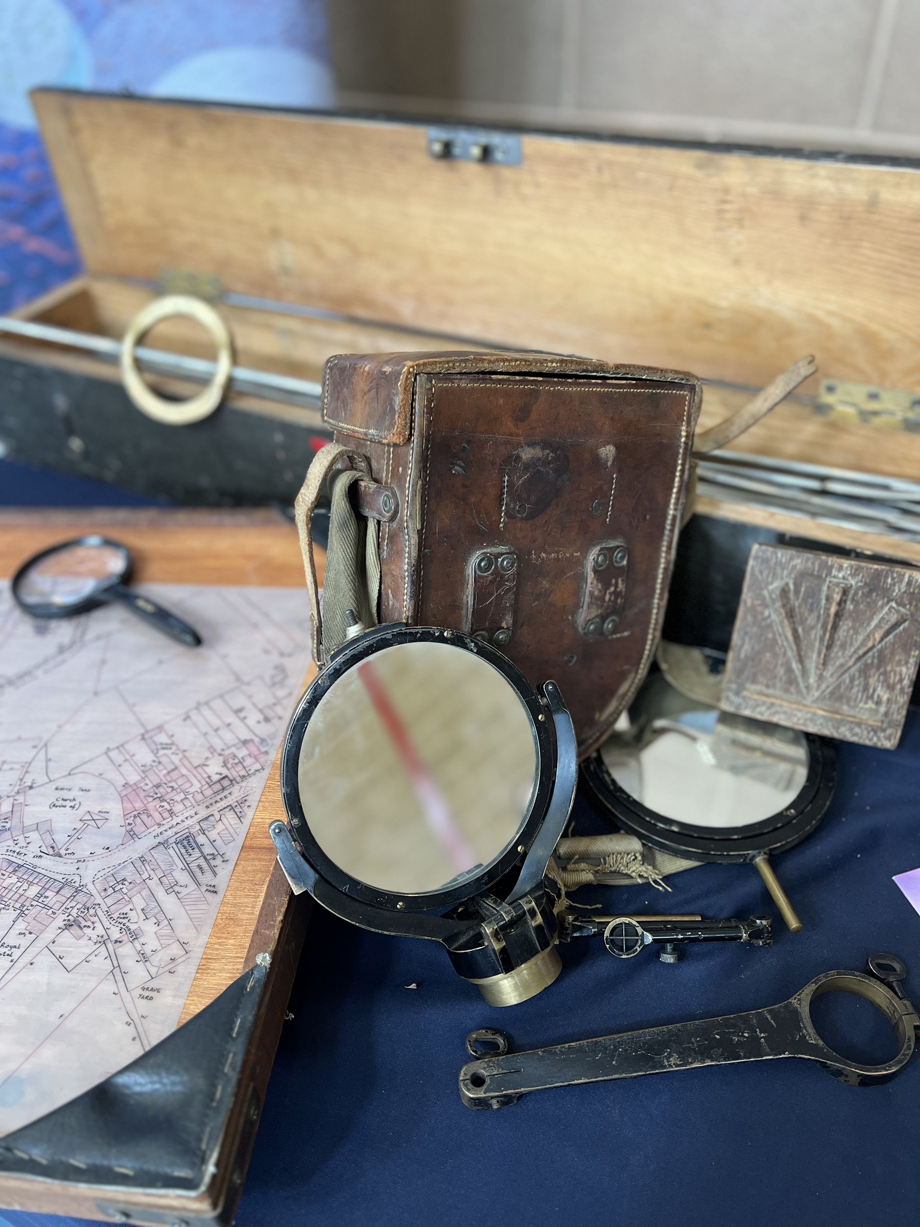

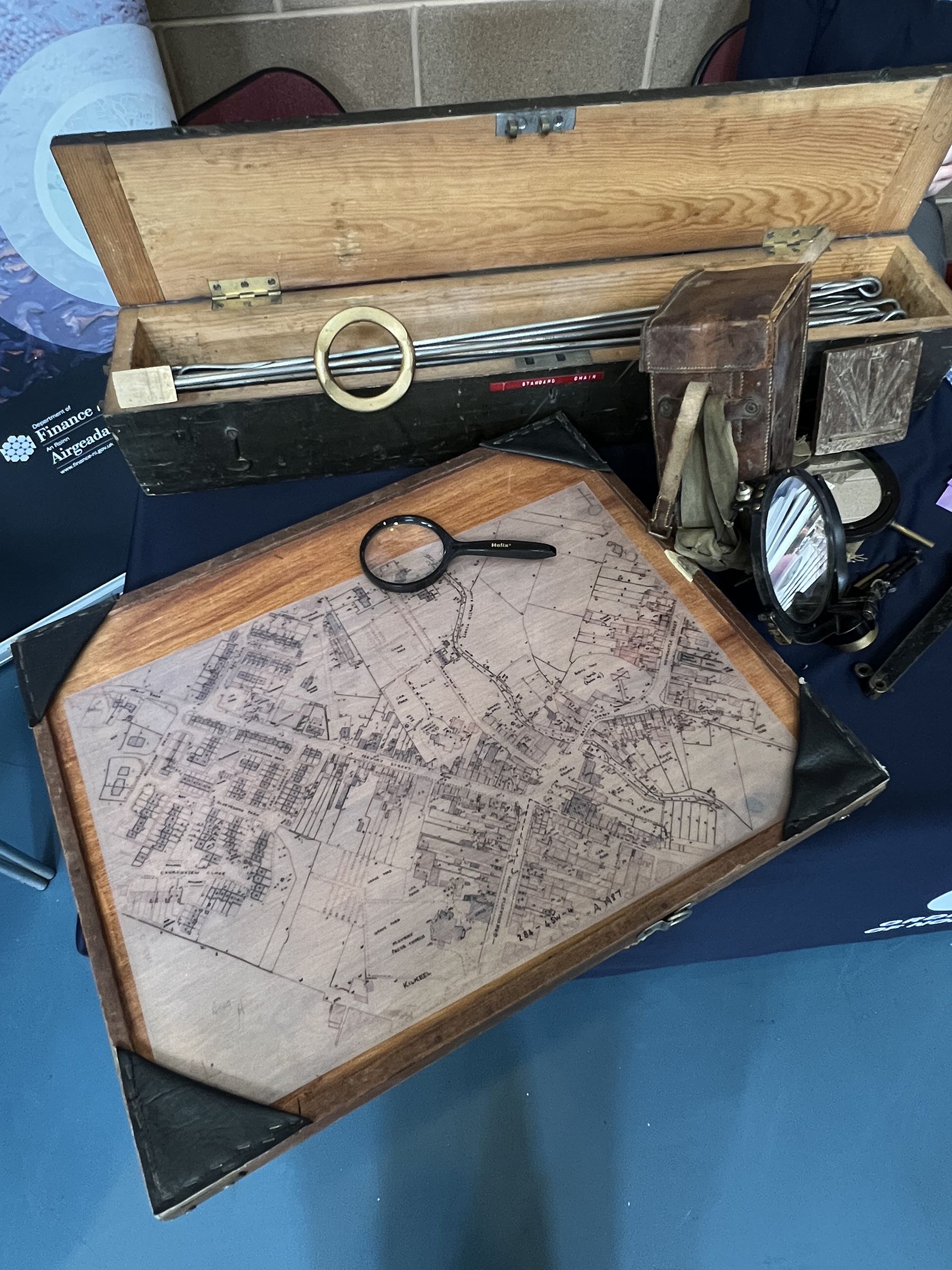
Working in partnership with National Trust, Queen’s University Belfast, Ordnance Survey Northern Ireland and the Historic Environment Division, the project will investigate and raise awareness of important trig points (triangulation pillars), which were used to create the first detailed maps of Ireland in the 19th century. These structures are a tangible link to the past and help connect us with the evolution of how we see and record place and space.
Maps and Memories will deliver a wide-ranging and inclusive programme of public engagement, including:
Oral history collection from local communities, walkers, retired surveyors, and people with memories of living and working near these mountains.
Talks, guided walks, and outdoor events, including a series of events as part of future NI Science Festival programmes.
Creative workshops, exhibitions and public art, encouraging reflection on place, history, and identity.
Schools outreach to inspire learning in geography, history and science.
Volunteer training opportunities.
The creation of a digital archive that captures and preserves this hidden history for future generations.
The funding will also support the creation of a new part-time role to coordinate the project and provide multiple opportunities for volunteering and community involvement throughout the two years.
To launch the project, NI Science Festival hosted a special event as part of the Festival of Archaeology. Held on Divis and the Black Mountain, the free event included a talk by Professor Keith Lilley of Queen's University, exploring how the first maps were made and what they reveal about the land. Details and booking information for future events will be announced at nisciencefestival.com and via NI Science Festival’s social media.
Speaking about the launch, Sarah Jones, Director of NI Science Festival, said: "We’re delighted to begin this exciting journey into the hidden history of mapping in Northern Ireland, thanks to the support of National Lottery players. These landscapes hold powerful stories — of science, land, power, and people — and we’re thrilled to explore them with communities across the region."
L-R) Professor Keith Lilley, Queens University Belfast, Dr Suzanne McLaughlin, Chief Survey Officer & Director, Ordnance Survey Northern Ireland, Sarah Jones, Director, NI Science Festival, Heather McLachlan, Director for Northern Ireland at National Trust and Dr Paul Mullan, Northern Ireland Director of the National Lottery Heritage Fund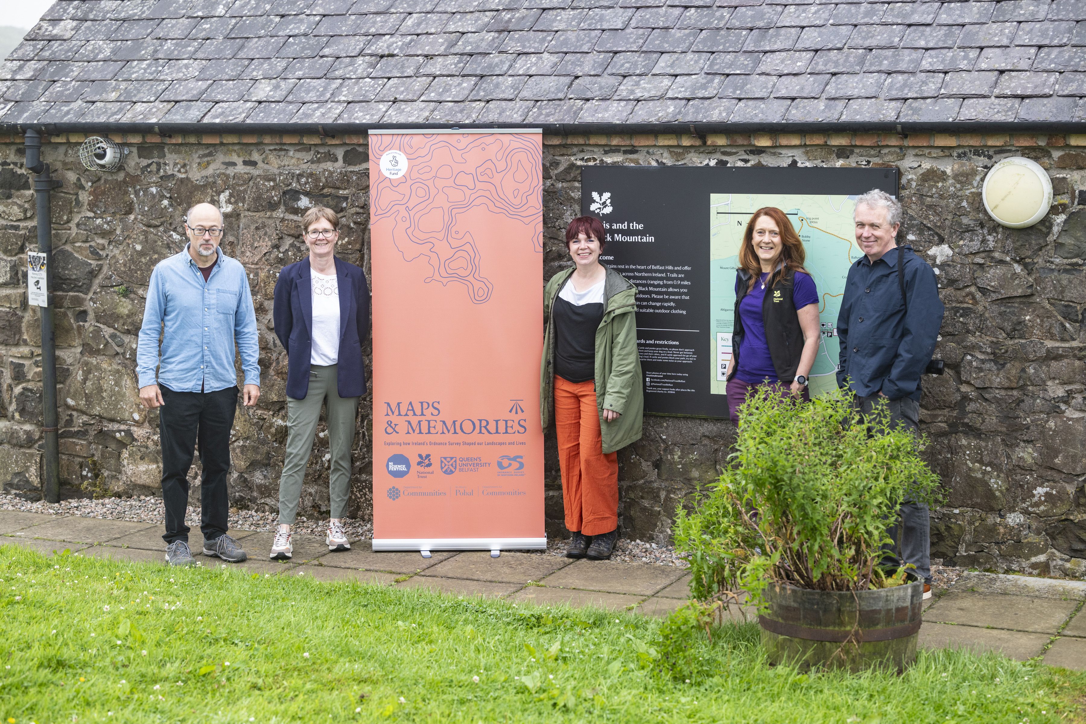
Dr Paul Mullan, Northern Ireland Director at The National Lottery Heritage Fund, said:
“Heritage can be anything from the past that people value and want to pass on to future generations. Maps and Memories is a remarkable and innovative project that will provide a range of opportunities for people of all ages to discover the legacy of local landscapes. Whether that’s through volunteering, sharing their stories or participating in school or public events, we know that this hidden heritage will be uncovered, understood and valued.”
Professor Keith Lilley, Queen's University Belfast, said: "Maps and Memories taps into a very exciting and important topic which always resonates strongly with local communities interested in exploring 'heritage on our doorstep. Maps are a great way to understand the places where we live, for drawing out memories about life in the past and sharing these for future generations. Here at Queen's, our expertise in heritage and mapping will play a role in supporting Maps and Memories, and we look forward to working with the project's partners and our local communities.”
Suzanne McLaughlin, Ordnance Survey NI, added: “Ordnance Survey of Northern Ireland is delighted to support this National Lottery-funded project, which reflects on the rich history of surveying and mapping while showcasing our current technologies. Maps tell stories, define journeys, empower informed decision-making, and serve as powerful tools that help people connect with the world around them which makes this an exciting project to be involved with."